


Garigal National Park
Middle Harbour, North ShoreGarigal National Park is not confined to one specific location or locality, but encompasses much of the remaining stands of natural bushland on Sydney's Upper North Shore, particularly those around Middle Harbour Creek and its tributaries. Vegetation varies throughout the park, from the heathlands of the eastern section with year round blooms of wildflowers, mangroves which grow alongside the middle section of the main walking track, to the more heavily forested areas of the south where tall Sydney redgums tower over leafy forest glades. Scribbly gums, thus named because of the patterns left by a burrowing insect, dominate the drier ridges, whilst wattles, tea-trees, boronia, wax flowers, grevillias and Banksias populate areas of poorer drainage.
Bungaroo
Wildlife abounds - red wattlebirds, magpies, parrots, honeyeaters and wrens can be seen and heard throughout the park. Lyrebirds inhabit the damp gullies of the Cascades area of the park. Rarely seen, evidence of these shy birds may only be a stray but beautiful tail feather or their characteristic "pilik-pilik" call. Mimicry of other bird species is a specialty of the lyrebird. A walk in the heaths early in the morning is most rewarding. The walking tracks and fire trails of the northern section and the Cascades tracks of Davidson Park around and below the tidal limit of Bungaroo are easy to negotiate. These can be easily accessed from such localities as St Ives, Gordon, Belrose and Davidson.
Public transport: bus No. 582 from Gordon Station. Alight at Hunter Avenue, St. Ives. Or train to Gordon Station. Bus No. 582 to Acron Road, St Ives. Alight at Douglas Street. Enter park through Douglas Street entrance.
Click on or tap an attraction to read the description. Click or tap again to hide the description.

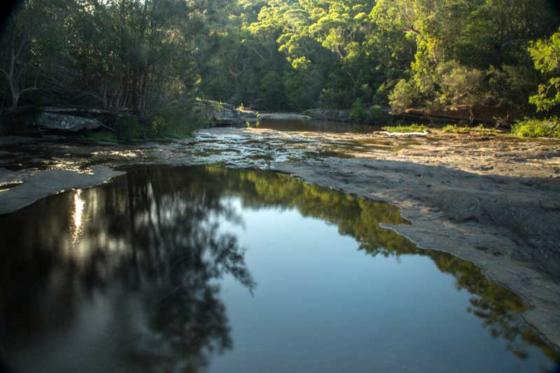
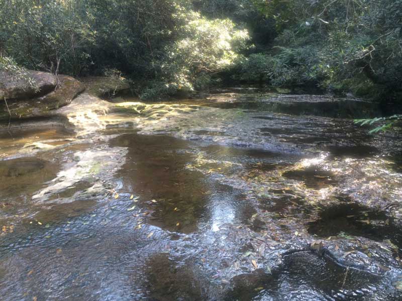
The northern part of the Park is the most isolated, but for those with a sense of adventure, it is the most rewarding. The Cascades are a series of beautiful rock pools at the junction of French's Creek and Middle Harbour Creek. The waters from Middle Harbour Creek enter the pools in a massive shallow sheet trickling over flat, water-smoothed rock paving. Bare Creek flows over a series of splendid waterfalls but access is difficult. Views of the forested valleys, with step-like sandstone ridges appearing to hold the mountains up and the quietness of the tracks gives a feeling of isolation not usually associated with a suburban park. Access is by a series of walking tracks and fire trails from the following entry points: Douglas Street (East), St. Ives; McIntosh Lookout, Mona Vale Road; Wyatt Avenue, Belrose; Ralston Avenue, Belrose; Stone Parade, Davidson.
UBD Map 155 Ref L 11. Davidson Park.
Public transport: train to Gordon station. Bus No. 582 to Acron Road, St Ives. Alight at Douglas Street. Enter park through Douglas Street entrance.

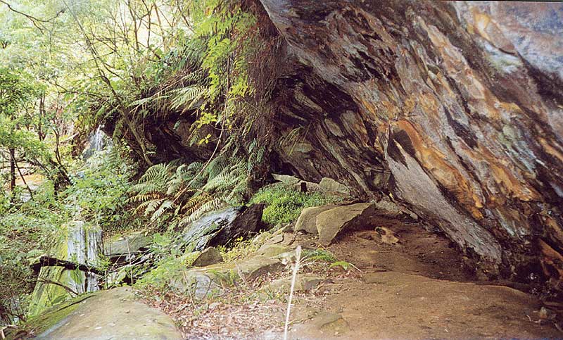
After Oxford Falls, a pair of waterfalls on the upper reaches of Frenchs Creek at Belrose would have to be the most visually stunning of all waterfalls of the inner Sydney metropolitan area after rain. Located off the badly eroded Frenchs Creek Walking Track in Garigal National Park, they consist of a pair of giant steps a hundred or so metres apart over which the creek flows on its way from the top of the escarpment into the valley below.
Access to the top of each falls is good, however for the best view (from the rock pools at their base) one has to struggle down a steep, rugged hillside while pushing through dense undergrowth. This is quite dangerous, especially after rain when the foliage overhead and ground underfoot is damp, slippery and unstable. Unfortunately, this is when the falls are at their most spectacular.
Access is via the walking track at the end of Wannita Road, Belrose.
A 16 metre high waterfall that flows deep in the relatively untouched bushland of Garigal National Park at the northern end of Bantry Bay. The falls may be reached via the Cook Street Track which has entry points in Cook Street and Currie Road, Forestville. Another path to its east, The Bay Track, takes bushwalkers past three smaller waterfalls on the Main Creek and a natural rock arch. The Bay Track can be accessed from the eastern shore of Bantry Bay or from the end of Grattan Crescent.
UBD Map 178 Ref J 13

Located at the head of Middle Harbour, this secluded bushland reserve is in the heart of Garigal National Park. Bungaroo has historical significance as it was here, where a rocky bar separates the salt waters of Middle harbour from the fresh water of Middle Harbour Creek, that an exploration party dispatched by Captain Arthur Philip camped on the night of 16th April 1788. It was the first of many inland treks dispatched by Philip in his quest to find land which could provide a food source for the colony.

Bantry Bay is a sheltered bay which has remained somewhat isolated from the rest of the city. Tucked away in a forgotten corner of Middle Harbour, it was deemed the ideal place for the storage of explosives in colonial times. The storage facilities still stand as a reminder of the bay's former use. Today, Bantry Bay is encompassed by Garigal National Park, and it only on foot via its bushwalking tracks that access is gained, unless you come here by boat.


Garigal National Park is home to the only natural rock arch in the Sydney metropolitan area. A sandstone arch, it spans an unnamed creek feeding into Bantry Bay. Though the Natural Bridge track uses the bridge to cross the creek, the bridge is not always noticed by walkers as the surrounding vegetation hides the full view of the feature from the track.
The easiest access to the arch is from Cook Street, Forestville, following the Bates Creek Track into the valley to an intersection where the signposted Natural Bridge Track heads off to the right. If you keep on the track after it passes over the bridge, it climbs the hillside before joining The Bluff track near the end of Grattan Crescent. The Bluff is large rocky point nearby, with plenty of interesting shapes and a fantastic view down Middle Harbour and across to the city (below).

- Get Directions
- Ku-Ring-Gai Chase National Park
- Cowan Creek
- Terry Hills
How to get there: Garigal National Park can be entered from most of the suburbs that surround the Park. For more information, click on the attractions within the park (left) for details of how to access that section of the Park.
Localities and Attractions

