Foundation Park, The Rocks
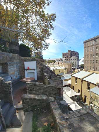
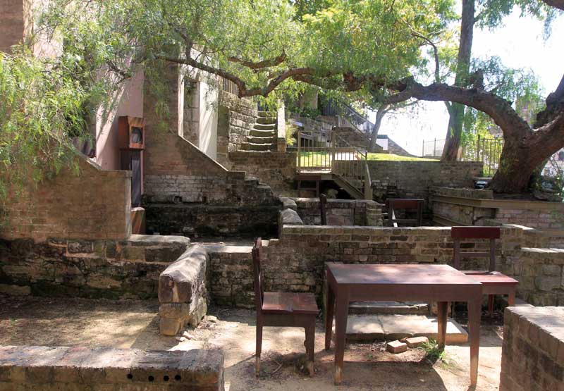
Foundation Park is a little known gem away from the main tourist area of The Rocks. Hidden behind a row of shops on Playfair Street, the site is made up of what were formerly No's 2-16 Gloucester Street, eight terrace houses constructed in the mid-1870s that were demolished in 1938.
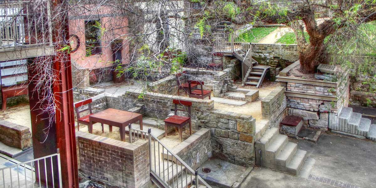
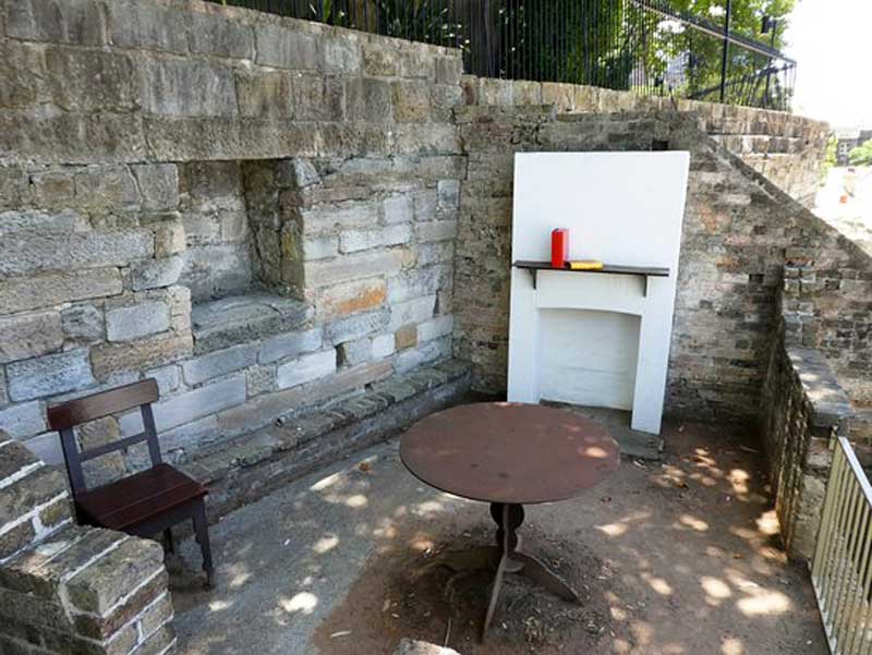
The park was created on the site in 1972. Offering a unique opportunity to step back in time, it was landscaped to complement the adjoining Argyle Arts Centre in 1993-1996, with the foundations of the houses and sculptural interpretation incorporated into the park design. Visitors can walk through the ruins of the eight houses that were progressively built into a sandstone cliff face from 1874 to 1878.
Perched on a steep, rocky hill, it is hard to imagine why anyone would build on such difficult land, but The Rocks was so densely populated during the 19th century that every spare piece of land was sought for housing. The rooms in the eight terrace houses were no larger than 3m x 3m, and demonstrate the cramped living conditions in the 19th century, compared to today.
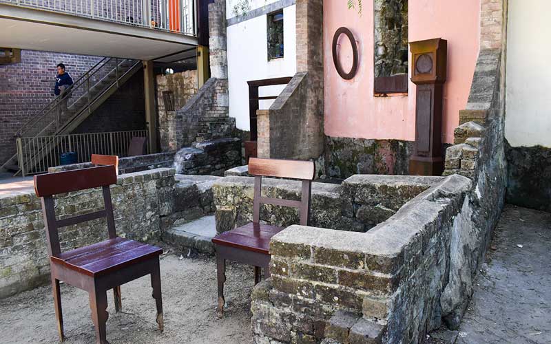
Back then, Sydney couples generally had between 4 and 10 children. When you walk around what’s left of the houses that stood in Foundation Park, you can imagine how difficult it would have been to accommodate such a large family in such small spaces. Many of the rooms are filled with models of 19th century furniture, which demonstrate how cramped living conditions really were. The furniture and other household goods give you a sense of how the rooms were used.
Foundation Park is open daily. It is located at Gloucester Walk, behind the Playfair Terrace shops. The site is in between George Street and Cumberland Street in the centre of The Rocks.
The site probably formed part of a land parcel granted to William Balmain (1762-1803) in 1795. Balmain was assistant surgeon to New South Wales at the time, and became principal surgeon to the colony when John White returned to England in 1796. When Balmain left the colony in August 1801, much of his property, including that in The Rocks reverted to the Crown. In 1816 the hospital relocated to Macquarie Street and much of the old hospital land became available for private uses.The site lies in the western half of an unmarked allotment sandwiched between John Piper to the south and John Laurie to the north.
The irregular terrain and lack of formal sub-division, or a regular grid of streets, resulted in the development of very irregular pattern of blocks and lots that reflected the natural topography. A network of pedestrian lanes and steps connected the streets that also served to delineate the blocks. Like many of the streets in The Rocks, Gloucester Street (now Walk) was originally a path that followed the natural terrain. It ran in a north-south direction, along the rock shelf that formed the western boundary of the first hospital and gaol, and led to rows of huts built on the naturally occurring rock shelves.
The site has important associations with the Cadigal people, for whom it was part of a strip of land along the western shore of Warrane (Sydney Cove) which they called "Tallawoladah". The fact that this area was named denotes it as a special or particular place for the indigenous peoples of Sydney Harbour before the arrival of European settlers.